Caskoak-MAP-PPp.jpg
1 2017-08-09T19:54:27+00:00 Lauren Tuiskula b7c9c11aacd058b57ca4a71131c107a00033aab2 6 1 plain 2017-08-09T19:54:27+00:00 Lauren Tuiskula b7c9c11aacd058b57ca4a71131c107a00033aab2This page is referenced by:
-
1
2017-05-29T18:41:46+00:00
Prologue: Caskoak, the Place of Peace
48
plain
2018-01-18T03:26:08+00:00
From this page, you can view all the media associated with the Prologue of Our Beloved Kin: A New History of King Philip's War. Click on the links under "Maps" to get immediate access to the full color maps created for this chapter. Click on the links under "Connections" to view these maps in historical and geographical context, alongside contemporary images of places and other related media.Maps
Native Homelands of the Northeast (Map 1)
Caskoak and surrounding territories (Map 2)
Wabanaki Trails MapConnections (Media in Context)
The Place of Peace
The Queen of Caskoak
Warrabitta of Owascoag
-
1
2017-05-29T18:42:10+00:00
Warrabitta of Owascoag
21
image_header
2018-01-18T16:45:42+00:00
The corn fully ripening and the salty marshes drawing cool winds, the saunkskwa Warrabitta and her mother met with the English brothers nearby their field at Owascoag, a "place of good grass," just south of Caskoak, the place of herons. They were there to renew a relationship, negotiate the sharing of space, and receive acknowledgement.
Warrabitta, also known as Joane (Jhone) or Jane, belonged to a web of leadership families on the coast and her family was represented in several deeds across the region. Her brother Skitterygusset appeared on an early deed for land in Casco Bay, in which he appeared to transfer ancestral land to the “fisherman” Francis Small, extending from Capissic, below the Presumpscot river’s mouth, to the fishing falls and planting grounds at Ammoncongan. Small pledged an annual “pay” of “one trading coat,” a symbolic recognition of Skitterygusset’s leadership, and “one gallon of liquor.” Yet this was not a simple purchase. These agreements were solidified through the exchange of wampum and tobacco, as Small later testified, symbolizing a commitment to share space, a negotiated relationship.[1]
In 1666, Warrabitta signed a deed allowing Boston colonist George Munjoy to settle land “on the other side of Amancongan River at the great Falls the upper part of them called Sacarabigg,” where there was another planting ground, “and so down the River Side unto the lowermost planting Ground,” a considerable tract on the Presumpscot River.[2] These falls at Sacarappa (Westbrook) and along the river became the site of considerable protest by Wabanaki people in 1739, when the leader Polin protested the impact of colonial dams on the free passage of salmon and their subsistence.
In 1670, as colonial pressure on coastal lands increased, Warrabitta put her “seal” to an “Indenture,” for land “lately Granted by the Townsmen of Falmouth unto…Anthony Brackett,” covering “four hundred acres of land lying upon the Long Creek in Casco Bay.” She acknowledged receiving “twenty shillings,” from Brackett. The deed also featured “a place for the Mark” of her brother Sagawetton, who dwelled with his wife’s family on the Saco and Kennebunkport rivers, to the south. Warrabitta appeared on deeds regarding land from Owascoag to the Kennebec River, demonstrating her wide influence and connections to “neighboring sachems” on the Wabanaki coast. Multiple Wabanaki leaders often participated in councils and negotiations that led to deeds, which were frequently signed by multiple representatives. [3]
The earliest deed on which Warrabitta appeared was at Owascoag, where she and her mother planted, created during the harvest. The 1659 deed recorded an earlier verbal agreement, made in 1651, in which she and Skitterygusset, alongside their mother, allowed land at Owascoag to Andrew and Arthur Alger. In 1658, when the town was surveyed in conjunction with its submission to the jurisdiction of Massachusetts Colony, there were only 23 white male adult “inhabitants” of Falmouth. The Alger brothers pledged an annual “acknowledgment” of a “bushel of corn” to the saunkskwak, recognizing their jurisdiction, as well, while acquiring proof of their claim to the land through Indigenous title.[4]
Women’s leadership in Wabanaki is rooted in agriculture, including the traditional story of the “First Mother,” known as Nigawes, “Our mother” corn. Penobscot author Joseph Nicolar includes the story of the First Mother and her emergence as corn in his 1893 book, The Life and Traditions of the Red Man. The symbolism of the "bushel of corn" was important, an acknowledgement of the role of women leaders and the Algers' place as contributors to a larger community, similar to the contribution Wabanaki families might make to the “common pot” during seasonal harvest festivals. Warrabitta and her family, following the “Queen” of Caskoak, strove to incorporate settlers into Indigenous cultural and economic systems, even as settlers sought their consent on finite political documents.
Warrabitta, her mother, and the women who planted and gathered beside them would have valued many of the plants growing in the marshes of Owascoag, including cattail, used for both food and weaving. The extensive marshlands of Owascoag can be viewed through this map, featured on Maine Memory, in the context of the colonial history of Scarborough. (Note that the page’s authors erroneously name the Native people of the region “Sokokis,” confusing the Connecticut River Valley people with those of the Sakôk, or the mouth of the “Saco” river.)
[1] York Deeds (Portland: John T. Hull) 1:83. Francis Small’s deposition, May 10, 1683, Pejebscot Papers 6:67, Maine Historical Society. Emerson Baker, “Finding the Almouchiquois: Native American Families, Territories, and Land Sales in Southern Maine,” Ethnohistory 51:1 (2004), 82-5. Alice Nash, “The Abiding Frontier: Family, Gender and Religiohn in Wabanaki History, 1600-1763,” PhD Dissertation, Columbia University, 1997, 148-189. F.S.Reiche, “Past Activities at the Mouth of Presumpscot River” (Falmouth, 1978), Special Collections, Maine Historical Society. Amy McDonald, ed., Guide to the Presumpscot River: Its History, Ecology, and Recreational Uses (Portland: Presumpscot River Watch, 1994), 4-6.[2] Waldo Papers, Box 1, Coll 34, Folder 1/1, Maine Historical Society. William Willis, History of Portland from 1632 to 1864 (Portland: Bailey & Noyes, 1865), 103, 108-110. Baker, “Finding the Almouchiquois, 84.[3] Deed from Warrabitta and Nanateonett to George Munjoy, June 4, 1666, Waldo Papers, Folder 1/1, Maine Historical Society. Baker, “Finding the Almouchiquois 85. [more cites re: deeds with neighboring leaders?] Nash, “Abiding Frontier,” 174.[4] York Deeds, (Portland: John T. Hull,1887), 2:114. Baker, “Finding the Almouchiquois,” 82-6; Nash, “Abiding Frontier,” 148-9, 174, 184-8. W. Southgate, “History of Scarborough,” Collections of the Maine Historical Society (1853), 1st series, 3:99-177. Fanny Eckstorm, “Indian Place-Names of the Penobscot Valley and the Maine Coast,” The Maine Bulletin 44:4 (1941), 168. Willis, History of Portland, 95. -
1
../media/images/presumpscot-river-IMG-PP-6.jpg
2017-05-29T18:42:10+00:00
The Queen of Caskoak
18
image_header
2017-08-09T19:59:32+00:00
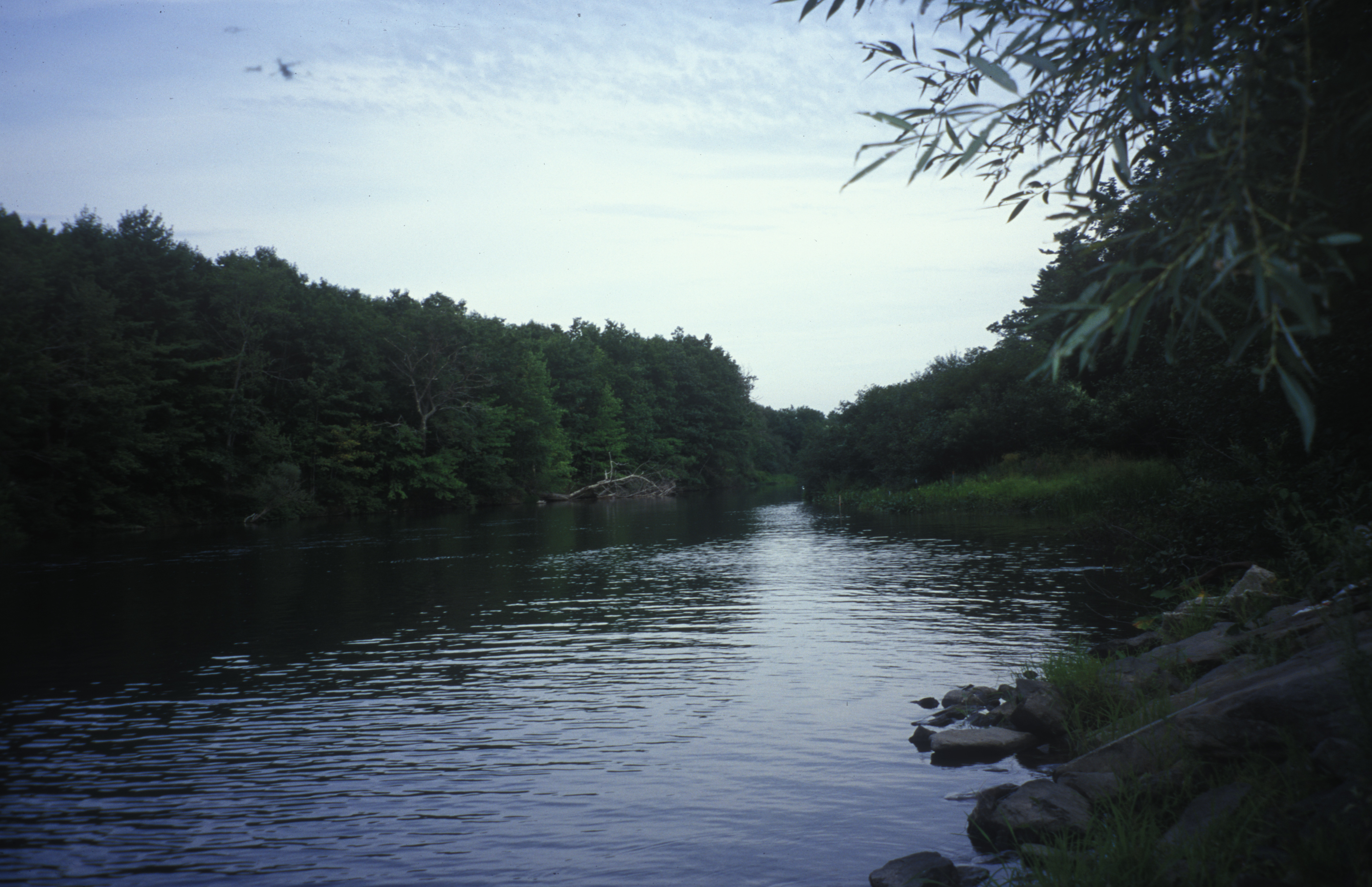
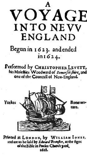
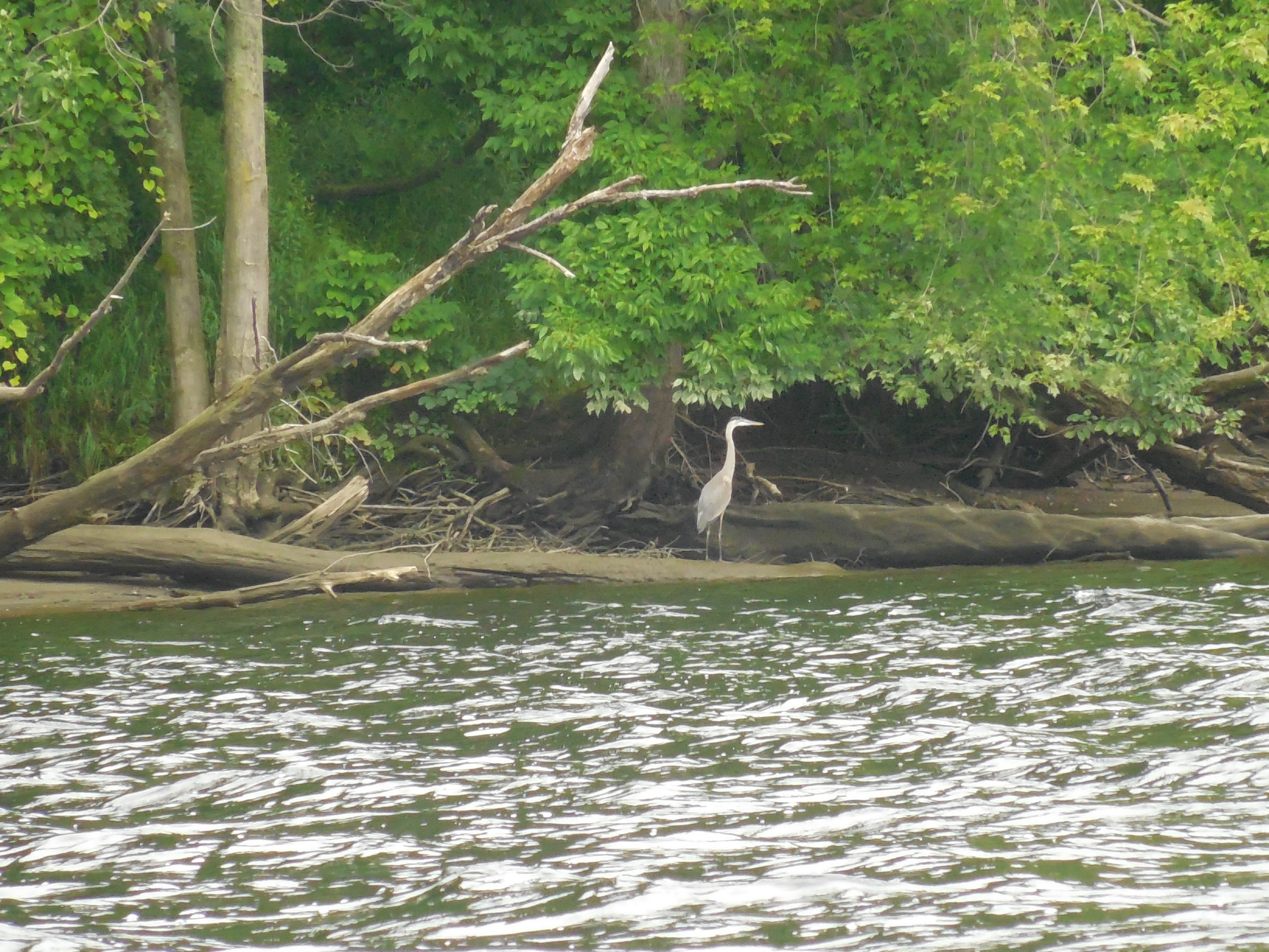
In A Voyage to New England, Christopher Levett described witnessing, and participating in, a Council among Indigenous leaders at the traditional meeting place of Caskoak, the place of herons, which he called “Quack.” He remarked that a woman, whom he only called “the Queen of Quack,” was the saunkskwa of this place. She formally welcomed Levett and the other visitors to her territory. There, he observed many places for fishing, including cod in Casco Bay, salmon on the Presumpscot River (pictured above), wild “fowl,” and “as much good ground as any can desire,” referring to the fertile planting grounds along the river. Caskoak was an ideal place for planting, fresh and saltwater fishing, and hunting, but it was also at the center of trade, facilitating distribution between communities to the south and northeast, as well as into the interior mountains. Even from the coast, Levett could see the “Christall hill,” or Wawôbadenik (White Mountains) to which the Queen’s territory was connected by waterways and paths.
Women’s leadership in Wabanaki is rooted in agriculture, including the traditional story of the “First Mother,” known as Nigawes, “Our mother” corn. Penobscot author Joseph Nicolar includes the story of the First Mother and her emergence as corn in his 1893 book, The Life and Traditions of the Red Man.
This place, which the English later called “Falmouth” then Portland (Maine), has multiple names. Caskoak evokes its identity as a meeting place, a confluence, a site of exchange and diplomacy. Recalling its other name, Machigonne ("it is bad" or "it does bad") Maliseet author Mihku Paul evokes its history of colonization and war, including the violence against its other-than-human inhabitants in her poem, “A Song for Machigonne.”A Song for Machigonne
Machigonne your truest name
before the French and English came to raid
the land of her tallest trees and pull the fish from
her blue knee.
The fur they took in trade for pots and drink and
rusty blades, could not sate their endless hunger or abate
their supernatural greed.
Oh, Machigonne, your name is dust.
You have begun to bleed.
Casco, now, is how they call the great neck as the mighty trees fall.
Land divided among men is stolen once again.
Waymouth kidnaps five of us before Gorges and John Mason arrive
to claim the eastern lands, and now we die and die.
The treaties cannot last when traders block the fish from
moving past, cows trample our corn, yet you say
we are a thorn in your side.
You are the ones who cannot abide by your own laws.
When we fight, we have just cause to grieve for Machigonne
and those who now walk beyond this world.
French or English, we must choose or so you say, if not
to lose the land we hold most dear.
We come away only to starve anew and now
our hearts are hard.
In spring of 1690, we gathered with Castine, our anger risen like the
streams you choked with nets to starve our kin, we followed one
trusted chief whose child the Baron sought to keep.
Madockawando leads the men and killing will begin.
Just for today we are many and will break our anger on your flesh,
burn your walls to nothingness.
Four hundred fighting men and more, with French to batter down
the door, we come to Machigonne to prove
Fort Loyal cannot stand
against our warring hand.
An English is a worse brigand than any Frenchman, so they tell us
when we fight and burn your forts down in the night.
We aren’t the ones you trusted to survive with white flag
waving before your eyes.
That was Burneiffe, who was in charge of
keeping order and giving quarter.
To trust is almost always wise but not to trust your English lies.
Thus you learn the bitter price you pay for our forgiveness.
Six wars were fought here, laying claim to land that
many tried to tame until we finally surrendered,
Penobscots, Micmacs, Malecite, Abenaki with little left
you had not plundered from our dawnland home.
The “Beaver Wars” were fought for pelts,
King Philip’s War, abuse of trade, and Squando’s child,
drowned just to see if he could swim, like some wild river otter.
Then scalp hunters seeking bounty came to Machigonne again.
King William’s War was fought for land, Fort William Henry could not stand against
Abenaki and French, who drove the English from the lower Kennebec.
In 1701 Queen Anne’s War came to our shores, when,
once again French and English wanted more and more and more.
Greedy bullets, dripping blades, smoking battlements laid waste and always
we must take a side, knowing we can no longer hide from settlers
thick as leaves on trees, coveting everything they see.
Dummer’s War for William Dummer, who sent Colonel Westbrook to
burn our homes and fields and starve us out.
Norridgewock fell, one hundred dead.
Pigwacket too, and if you wore the other shoe it would be dipped in red.
At last your war with France burned high, for seven years, and we had
nothing left to lose when forced to choose between
the evils that befell our people.
One in four of us was dead, gone to the wind and finally you said the line was
drawn in seventeen and fifty-nine, the words you give to white man’s time.
You name our demise victorious, so-called history and glory
fought for land paid in blood and bone.
Machigonne was just one, first become Casco, then Old Falmouth,
finally as the years wore on, Portland, Maine was born.
The massacre you blame us for is but the story of your shame,
and those sins for which you must atone.
Machigonne was not your own.
-
1
2017-05-29T18:41:48+00:00
The Northern Front
6
image_header
2017-08-11T00:32:35+00:00
Histories of King Philip’s War often focus on southern New England, but the war also had a northern front in Wabanaki country. This was both an extension of the war, as the colonies sought to extend their control and containment of Native peoples, and a conflict which had a local context, the “First Anglo-Abenaki War.” (link or cite: Kevin Sweeney and Evan Haefeli) This map highlights the locations of Wabanaki places and pathways within the Northern Front.
The map also highlights the waterways, trails and kinship networks that connected communities impacted by the war on the Northern Front. As Emerson Baker has written, “all Native peoples from south of the Kennebec River all the way to the north shore of Massachusetts [Molôdemak River] constituted a closely related group. They had distinct territories but intermarried and moved throughout the region.” (Baker, Almouchiquois, 74, 82, 91)
Madoasquarbet’s Message
These were the same networks which Massachusetts colony sought to contain after war broke out in Wampanoag, Narragansett and Nipmuc territory in the summer of 1675, fearing Native leaders from the south would seek assistance and alliance from Wabanaki people to the north.
In 1677, the Wabanaki leader Madoasquarbet conveyed a message to the Governor and Council of Massachusetts from Taconnic, on the Kennebec River, and described the outbreak of war on the Northern Front:
“Because there was war at Narraganset you came here when we were quiet & took away our guns & made prisoners of our chief sagamore & that winter for want of our guns there was severall starved.”
Madoasquarbet spoke of two of the major causes of war on the Northern Front: the attempted disarmament of Wabanaki people from Newichiwannock to the Kennebec, and the captivity of a Wabanaki sagamore and his kin far up the coast [link]. Importantly, Madoasquarbet expressed that “we were quiet,” that is, in a state of peace or stillness, before traders and settlers, authorized by Massachusetts’ colonial government, sought to confiscate their guns. Further, Madoasquarbet described the consequences of this action, given that Wabanaki men (fathers, sons, uncles, nephews) required their “arms” mainly for hunting. This unwarranted disarmament not only was a violation of their personal and collective sovereignty, but had dire impacts on sustenance. This was a real blunder in colonial strategy. Rather than containing the war, it extended the conflict.
Thomas Gardner’s Relation
The trader Thomas Gardner lived at Pemaquid and had a comparatively good relationship with the Wabanaki people on the Kennebec River who came to trade at his post. He wrote to Massachusetts Governor Leverett in September 1675, expressing his rising concern:
“Sir I Conceive the Reason of our Troubles hear may be occationed not only by som southern Indianes which may Com this way But by our owne Acctings…Sir, upon the first Newes of the warres with the Indianes at Plimouth divers persone[s] from Kenibek & Shepscott got togeather makeing them selves officers & went up Kenibeke River & demanded the Indianes Armes.” (92) Gardner noted that “Lieutenant Silvanus Davis did againe Requier their Armes but thay Refused to deliver them.” Gardner critiqued these actions, noting that “these Indians Amongst us live most by Hunting as your Honnor well Knoweth how we cant take away their armes whose livelihood dependeth of it”
“And seeing these Indianes in these parts did never Apeare dissatisfied until their Armes wear Taken Away I doubt if such Acctions may force them “to go the French for Releife or fight Against us having nothing for their support Almost in these parts but their guns.”
Responding to the incursions and fears of local settlers, as well as the reports coming from the south, Wabanaki protectors soon joined to begin their own campaign on the structures of settlement that impacted their subsistence. [NEXT PAGE]
Maine Memory Network Map of New England and New York